.png)
.png)
.png)
.png)


Trending Searches

Digital Room Measurement and Spatial Renovation Workflow with SHARE SLAM S20
1. Industry Background
In recent years, the home renovation industry has entered its fourth phase, centered on “technology-driven transformation.” Technologies such as big data, artificial intelligence and the Internet of Things have become deeply integrated with renovation workflows, driving companies toward refined operations and personalized services. This shift delivers a more efficient, customized and transparent renovation experience for consumers.
Against this backdrop, real-scene 3D LiDAR scanners such as the SHARE SLAM S20 are gradually replacing traditional manual measurement methods and becoming a new standard in home renovation. They not only enable high-precision, high-efficiency and low-cost digital measurement, but also generate immersive 3D Gaussian models that provide a solid data foundation for managing the entire renovation lifecycle.
2. Traditional Room Measurement Method

3. Project Solution
3.1 Project Overview

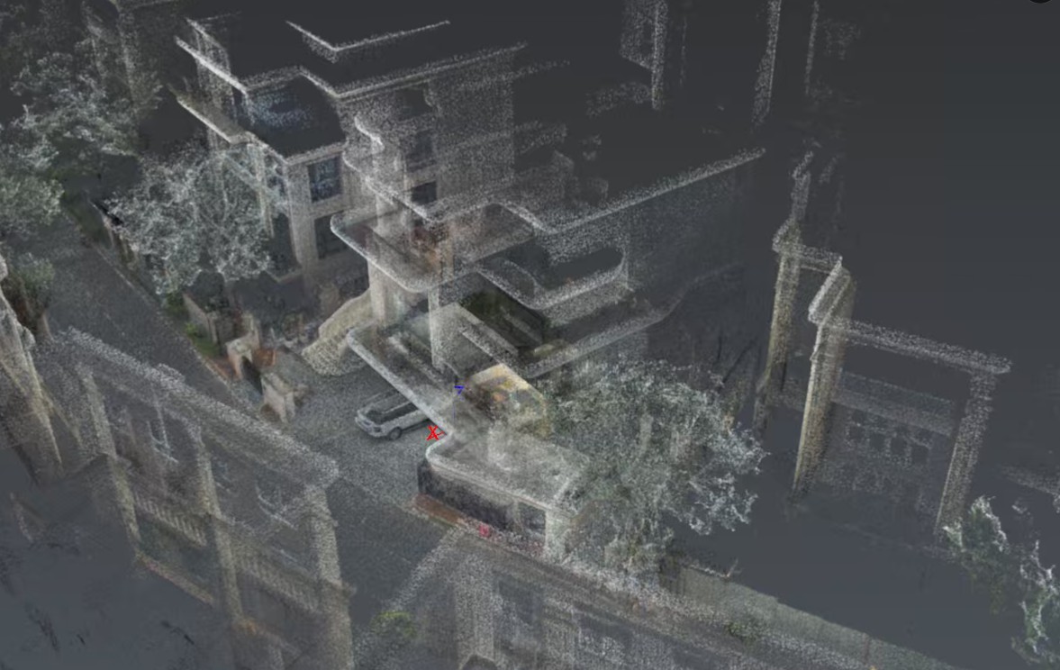
• Scene Data Scan: Confirm the scanning scope and targets, pre-plan field data collection routes and personnel arrangements, and select the appropriate capture equipment based on scene size, accuracy requirements and color needs to acquire indoor point cloud data.

• Point Cloud Data Management: Import the raw point cloud data collected on site into SHARE PointClouds Studio. The software automatically performs post-processing and generates colored point cloud data, while trimming and retaining only the required data and removing unnecessary noise.

• Extraction of Room Measurement Data: Processed point cloud data can be measured at a 1:1 scale in SHARE PointClouds Studio to obtain accurate real-world dimensions.

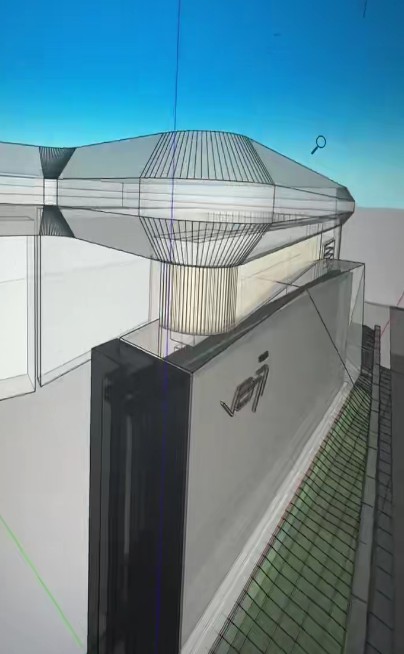
• Data Extraction from Home Renovation Blueprints: Import the processed point cloud data into CAD, SketchUp or similar software to create CAD drawings, BIM models and other architectural deliverables.

3.2 Process Flow
Flow: Use the S20 for on-site scanning (only 5–10 minutes) → output point cloud results → point cloud slicing (ReCap Pro) → draw CAD diagrams (AutoCAD) → output CAD design deliverables (AutoCAD) → point cloud rendering for BIM models (SketchUp) → export BIM models (SketchUp) → output BIM design deliverables (SketchUp).
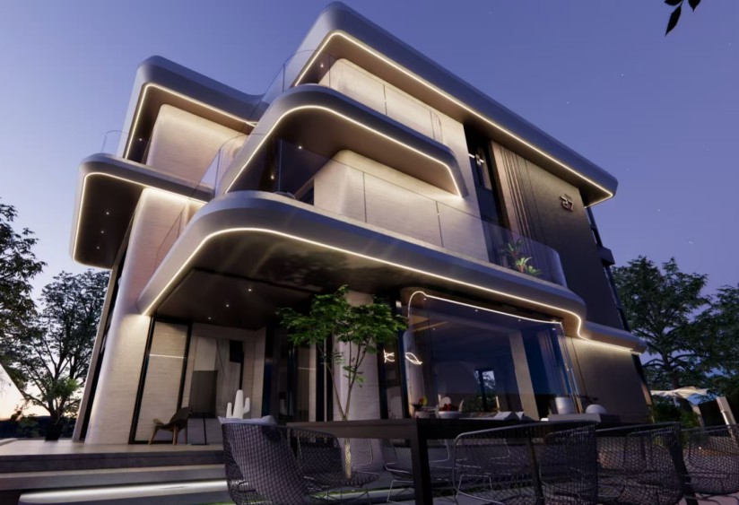
3.3 Project Deliverables
• Reverse Modeling: Reverse modeling of pipes and wires in SketchUp.

• 3D Gaussian Modeling: Point cloud generation for 3D Gaussian models and final inspection photography of newly completed properties.

3.4 Comparison of Measurement Methods

3.5 Accuracy Verification
Objective: To validate the efficiency and accuracy of 3D LiDAR scanners in real estate surveying, a 100 m² sample plot was selected as the test area. Both traditional surveying instruments and the SHARE SLAM S20 3D LiDAR scanner were used for point cloud data acquisition, and a comparative error analysis was carried out for operating time, area measurement and edge-length distance.


4. Advantages and Application Value of the Solution
Precision and efficiency with near-zero error: Complete whole-house scanning in minutes with millimeter-level precision, accurately mapping complex structures and irregular spaces to eliminate rework and material waste caused by dimensional errors.
For designers, this means fast access to real-world spatial data, shorter design cycles and improved design fidelity.
Digital archiving with full visibility: Generate a 3D digital base map before renovation, clearly document pipeline locations and structural details for future maintenance and remodeling, and create a “digital portrait of the new home” after completion.
For homeowners, this provides a permanent digital archive of the property, making future partial renovation faster and more convenient.
Controllable costs and evidence-based decisions: Acquire comprehensive spatial data with a more economical investment to support design, quoting and construction, effectively control renovation costs and enhance project management transparency.
For contractors, this provides more accurate guidance for plumbing, electrical positioning, custom furniture installation and other processes, reducing communication costs and on-site errors.
5. Case Studies
(1) Xiamen Seaside Villa Renovation Project
Background: A premier design firm in Xiamen specializing in turnkey high-end custom interior design for villas and similar properties. This project involves a standalone seaside villa in Xiamen and requires comprehensive turnkey interior design together with exterior landscaping and garden design.
Traditional measurement method: The total indoor and outdoor area is approximately 1,000 m². Initial measurement requires two people working for one day across both interior and exterior scenes, followed by several supplementary visits.
Pain Points:
• Room measurements are mainly handled by design assistants, requiring high skill levels and resulting in high staff turnover and training costs.
• Using single-point measurement tools leads to low efficiency.
• Irregular structures are measured inaccurately, causing design drawings to become distorted.
• Special-shaped spaces are prone to omissions, and repeated site visits waste time and labor costs.
SHARE’s solution:
• During the measurement phase, the SHARE SLAM S20 SE was used. Indoor scanning took 10 minutes, outdoor scanning took 10 minutes, and comprehensive measurement data was collected.
• Processing in SHARE PointClouds Studio took 50 minutes to generate complete point cloud data. Transferring this data into CAD software took approximately 10 minutes to produce the required drawings.
• For irregular structures or supplementary measurement needs, additional measurements can be completed directly on the point cloud model.
Advantages:
• Only one site visit is required, and all data can be collected within half an hour, minimizing disruption to homeowners.
• New staff can master the process quickly, and a half-day training session is enough for complete data collection.
• Data can be reused multiple times, reducing the cost of repeated measurements.
• Strong data visualization makes reference and review easier during the design phase.
(2) Water Pipes and Concealed Electrical Piping Documentation
Background: When renovating a bare unit, it is essential to document concealed work to support future renovation, maintenance and rapid troubleshooting of hidden piping and wiring.
Traditional method: Archiving with panoramic images and paper line drawings.
Pain points:
• Panoramic image archives without dimensions only allow rough estimates, making locations difficult to identify accurately during later excavation.
• At intersections, this increases the risk of damaging other pipelines and causing unnecessary losses.
• Paper maps are prone to loss or damage, making the records unavailable when they are most needed.
SHARE’s solution:
• The SHARE SLAM S20 SE was used to scan the room in about 8 minutes, capturing point cloud data, photographic data and other complete room information.
• Processing with SHARE PointClouds Studio took about 2 minutes to generate complete point cloud data, distortion-free images and 3D Gaussian data.
• Based on the point cloud, reverse modeling was carried out for water pipes and electrical wiring to generate manageable BIM data.
Advantages:
• Eliminates the risk of failing to locate concealed pipes during maintenance and renovation, enabling highly accurate positioning.
• Provides better visualization, easier electronic archiving and even the option to print the results as decorative records.

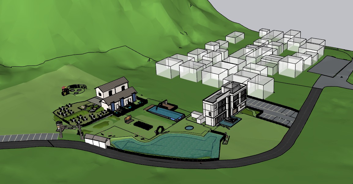
(3) Renovation of a Homestay in Qingyuan
Background: A planning and design project for homestay renovation in Qingyuan, helping turn an undeveloped site into a fully designed property from scratch.
Traditional method: Measurements were taken using tape measures and single-point distance meters, often requiring repeated site visits.
Pain points:
• The area is too large to measure usable space accurately, requiring multiple staff members to collaborate on site.
• The volume of data is substantial, creating heavy workloads and often requiring several days of measurement.
• Projects are extensive and require different measurements at different stages, leading to repeated site visits.
• Long travel distances significantly increase time and personnel costs.
SHARE’s solution:
• During the data acquisition phase, the SHARE SLAM S20 was selected, and the entire scanning process took approximately 30 minutes to obtain the full dataset.
• Processing with SHARE PointClouds Studio took about 2 hours to generate complete point cloud data, which was then imported into SketchUp to create the required design graphics.
Advantages:
• Full data access enables more comprehensive macro-level design planning.
• Data reuse reduces the cost of repeated site measurements.
• Strong data visualization improves reference efficiency during the design stage.
• Raw data can be imported again at any stage, so additional on-site collection is only needed during major project phases.
• The RTK positioning function of the S20 enables effective fusion with onboard point cloud data.

6. Service Industry
We have provided spatial digitalization solutions for five major industries: home furnishings, decoration, building materials, chain retail and landscaping. The core value lies in significantly improving efficiency and reducing costs, minimizing errors and promoting digital transformation across the industry. Typical examples include saving 90% of measurement time for home furnishing companies, enabling rapid data collection and design synchronization for chain stores, and creating digital twin models for scenic areas to support smart operations.
Consult Now
Leave your contact information, and our dedicated consultant will contact you as soon as possible
Full Name*
Region*
Company Name*
Phone Number
Email*
Product Type You Are Interested In (Single Choice)
I understand and agree to our Privacy Policy and Disclaimer。
Application for Position
You are applying for the position of Algorithm Engineer. Please complete the information below to help HR get to know you better!
Full Name*
Region*
Phone Number
Estimated arrival time
Email*
Resume Upload
+
The file size should not exceed 10MB, and it should support doc, docx, and pdf formats
Upload Successful
Get link
If it's a link, please fill it in below. If the file is too large, please send it to the email: ningxingyu@shareuavtec.com, and make a note below


热门搜索: